
Weekend Surf Forecast: August 8-9, 2026
This is what our nearshore SWAN model has for the weekend of August 8–9, 2026 — a 50 m grid that carries swell all the way through the bathymetry to the sandbar and the reef, rather than stopping at the buoy 20 miles offshore.
Honest read before you scroll: this is a small weekend nearly everywhere. Seven of the eight regions we run come in at 1–2 ft, riding short-period windswell in the 5–8 second band. There is exactly one piece of real groundswell on the map — a 13-second SSW into Southern California — and one region worth writing off completely. The other thing worth knowing: all eight regions peak in the morning. Every single one. That is the summer sea-breeze cycle doing the same thing to every coastline in the country. Surf at dawn or don't bother.
A note on the numbers below: our window score runs Poor (0) → Fair (2) → Good (4), with negative values for Very Poor and flat. Confidence this weekend is high on size — small weekends are the easy call — high on the morning-window timing, and moderate on the Saturday-vs-Sunday peak in Southern California, where the south swell's arrival timing carries the most spread.
Jump to your coast
- Southern California — the only real swell in the country
- Northern California — dawn patrol or skip
- Pacific Northwest — a skip
- New York / New Jersey — knee-high mush
- New England — go north, not south
- Outer Banks — small, and gone by lunch
- Florida East Coast — best of the East Coast
- Puerto Rico — flat
Southern California

Surf: 2-3ft • Best day: Sunday AM • Conditions: Good
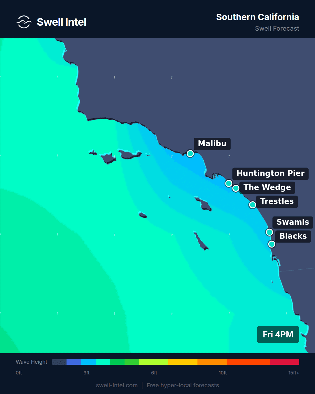
A 12–13 second swell out of 200–208° — SSW — is the only genuine groundswell anywhere in our coverage this weekend. That combination of long period and southwest angle is a Southern Hemisphere signature: a storm that spun up in the Southern Ocean roughly a week ago, with the long-period energy being the part that survived the trip north. August is the peak of that season, and this is a textbook example of it arriving.
Trestles is the standout at up to 5 ft, rated Good — the southwest-facing cobblestone at San Onofre lines a 200° swell up almost square. Malibu First Point and Huntington Pier both show up to 4 ft and Good, with Cardiff Reef right behind at up to 4 ft, Fair–Good. El Porto is the honest exception: 2 ft and Poor–Fair, because at 205° the Palos Verdes headland shadows the southern approach into Santa Monica Bay and the South Bay simply doesn't see this swell. One caveat on Huntington — the model's dominant band there is actually a short-period 4.4-second west windswell at 275°, not the south swell, so expect a wobblier, more mixed-up lineup at the pier than at the south-facing points. Regionally we're calling 2–3 ft; the 4–5 ft numbers are the standout spots on the sets, not what the average beachbreak will give you.
Sunday is the better of the two days, and the morning is not a suggestion: our AM window scores nearly three times what midday and afternoon do (2.4 against 0.9 and 0.9). That is the sea breeze on its usual summer schedule — light land breeze holding the faces clean until the thermal gradient builds mid-morning, then onshore texture for the rest of the day. Be in the water at first light and you get the best waves in the country this weekend. Show up at noon and you get the same waves everyone else is complaining about.
Northern California

Surf: 1-2ft • Best day: Sunday AM • Conditions: Fair
There is not much here, and what there is has no period behind it. Ocean Beach is running on 5.9 seconds from 170° (S) — a short-period south windswell, not the west-northwest groundswell OB is actually built for. Linda Mar in Pacifica is on 4.9 seconds from 292° (WNW), which is locally generated wind chop and nothing more.
Ocean Beach shows up to 4 ft and is the only size in the region, but at under 6 seconds that is shifty, closeout-prone sandbar surf — the peaks will move between paddle-outs and the sets will not have faces worth much. We're calling the region 1–2 ft overall and standing behind the small number. Linda Mar is 2 ft and Poor. This is a longboard weekend at best.
The timing is the harshest part: AM rates 0.9, midday 0.5, and the afternoon falls to −0.7. It degrades continuously through the day, which is the August NorCal pattern — the inland thermal trough pulling hard northwest wind onto the coast from late morning on. If you're going, it's a Sunday dawn patrol and you're out of the water before the wind arrives.
Pacific Northwest

Surf: 1-2ft • Best day: Saturday AM • Conditions: Poor-Fair
This one is a skip, and we'd rather say it than dress it up. Every window in the region rates negative on our scale — morning, midday and afternoon all sit below the Poor line. There is no time this weekend when the Oregon or Washington coast is good.
The whole coastline is on 6.9–7.0 second windswell from 293–308° (WNW to NW). That is the North Pacific in August: the storm track has retreated north toward the Aleutians and there is no meaningful fetch aimed at the Pacific Northwest. Cape Kiwanda is the least-bad option at up to 3 ft, Poor–Fair — the Pacific City headland offers some wind shelter and the beach angle takes the WNW better than its neighbors. Indian Beach is up to 3 ft but Poor; Seaside Cove and La Push are both 2 ft and Poor.
If you insist, Saturday morning is marginally the best of a bad set of options, and it decays from there through Sunday. Otherwise this is a weekend to service your gear. The North Pacific starts turning back on in late September, and when it does this coast is one of the most consistent in the country — it just isn't right now.
New York / New Jersey

Surf: 1-2ft • Best day: Sunday AM • Conditions: Poor-Fair
Knee- to waist-high mush. All three spots run 5.3–5.5 seconds from 153–166° (SSE), which is locally generated windswell off the southerly flow on the western side of the Bermuda High — wind chop that hasn't traveled far enough to organize into anything.
Manasquan is the pick at up to 2 ft, Poor–Fair. The inlet jetty gives an SSE angle something to groom against, and the New Jersey beaches sit more square to 153° than Rockaway does. Rockaway and Pacific Blvd are both 2 ft and Poor — soft, gutless, and closing out on the inside.
Sunday morning is the only window in the region that rates above zero at all (0.3, against −0.2 for both midday and afternoon). Bring the longboard, expect a crowd on the one rideable sandbar, and keep your expectations at the level the data supports. Worth noting for anyone watching the calendar: nothing in this weekend's model output carries a tropical signature — every band is short-period and local. When that changes on this coast, it changes fast, but it hasn't yet.
New England

Surf: 1-2ft • Best day: Sunday AM • Conditions: Poor-Fair
Same 2 ft everywhere in the region, but not the same swell — and that split is the one genuinely useful call in New England this weekend. Rhode Island's south-facing beaches are the weaker half: Narragansett and Misquamicut are both up to 2 ft and rated Poor, sitting on 5.6–5.7 second windswell from 182–186° (due S). Short-period, gutless, closing out.
Go north instead. Hampton Beach in New Hampshire and Nantasket in Massachusetts are both showing 9.1–9.2 seconds from 83–108° (E to ESE) — identical height, roughly 60% more period, and that is the difference between chop and a wave with an actual face on it. Both rate Poor–Fair, the best marks in the region. The reason Rhode Island misses out is geography: Cape Cod, Martha's Vineyard, Nantucket and Block Island form a near-continuous barrier across the eastern approach to the south shore. East energy lands on the Gulf of Maine beaches and never makes the corner. This is exactly the kind of distinction a 50 m nearshore grid resolves and a regional buoy average flattens into a single useless number.
Sunday morning is the window, and it's a gentle decay rather than a cliff — 0.2 in the morning, 0.1 at midday, then −0.5 by afternoon. It holds until early afternoon before the onshore wins. It is still only 2 ft. Surf it if it's local; don't drive two hours for it.
Outer Banks

Surf: 1-2ft • Best day: Sunday AM • Conditions: Poor-Fair
Small, and the East Coast's best swell magnet can't do much with it. Cape Hatteras is up to 2 ft, Poor–Fair, on 7.7 seconds from 136° (SE). Folly Beach Pier down in South Carolina shows up to 3 ft, also Poor–Fair, on 6.6 seconds from 134°.
Hatteras carries the longest period on the mid-Atlantic this weekend, and Cape Point is why — the cape juts far enough into the Atlantic that even a marginal southeast windswell gets refracted around it into something with shape. Folly has an extra foot of height but a full second less period, which means it will be the softer and mushier of the two despite the bigger number. Neither is worth a trip; both are worth a check if you're already there.
The morning-to-afternoon collapse here is the sharpest in the country: 0.7 at dawn down to −0.8 by the afternoon. That is the Carolina sea breeze, and it runs on a schedule you can set a watch by. Sunday at first light or nothing.
Florida East Coast

Surf: 1-2ft • Best day: Saturday AM • Conditions: Fair-Good
The best-rated conditions on the East Coast this weekend — which says as much about the East Coast right now as it does about Florida, but it is genuinely the most surfable option east of the Rockies. Cocoa Beach and Jacksonville Beach both show up to 3 ft at Fair–Good, with Sebastian Inlet up to 3 ft at Fair.
The source is a persistent easterly fetch sitting under the Bermuda High: 6.6–7.1 seconds from 83–105°, which is E to ESE and pointed almost dead-on at the east-facing Florida beaches. It's trade windswell rather than groundswell, so don't expect power out of it — but the direction is square, and squareness is why Florida rates cleaner this weekend than anywhere north of it. Sebastian Inlet needs more size and more period before the jetty starts doing what makes it famous; at 6.7 seconds, Cocoa and Jacksonville Beach are the better calls.
Saturday is the day, and Florida is the single region where you don't have to be up before sunrise: morning and midday score identically at 1.2 before the afternoon sea breeze knocks it down to 0.2. Waist- to chest-high, reasonably clean, and worth a session — just calibrate expectations to 2–3 ft rather than the sets you're hoping for.
Puerto Rico

Surf: 0-2ft • Best day: Saturday AM • Conditions: Poor
Flat. It's the off-season and the model shows it plainly — 0–2 ft with every window of every day rating below the Poor line. Maria's in Rincon is 1 ft and Very Poor. Wilderness, up near Aguadilla, is 2 ft and Poor. There is no session here this weekend, and pretending otherwise would waste someone's morning.
The only energy in the water is 7.9–8.0 seconds from 55–57° (NE to ENE), which is trade windswell brushing the north coast. Wilderness faces N/NW and takes what little of it there is, which is why it's double the height of Maria's. Maria's faces W/NW and is effectively shadowed from a northeast angle — there is nothing there to ride.
This is entirely normal for August, and it's worth saying so rather than treating it as bad news. Puerto Rico's north and west coasts run on North Atlantic groundswell from roughly October through April; the machine that makes Rincon and the Aguadilla coast worth a plane ticket doesn't switch on for another two months. Dive, swim, and check back in the fall.
The one-line version
Southern California on Sunday morning is the only place in the country with real waves this weekend, and Trestles is the pick. Florida on Saturday morning is the East Coast's best shot. Everywhere else is small, short-period, and best surfed at dawn if at all — and the Pacific Northwest and Puerto Rico are honest skips.
Track it live
Conditions move faster than a Friday forecast. Track it live in Swell Intel — nearshore SWAN forecasts at 50 m resolution for every spot above, updated as the model runs, so you know whether the morning window held before you load the car.
📱 Get spot-by-spot forecasts, dawn patrol alerts, and buoy-trained ratings in the SwellIntel app.