
Northern California Surf Season: A Month-by-Month Guide to Santa Cruz and the NW Swell Window
Ask most surfers when Northern California is at its best and they will say winter. That is when the North Pacific throws its heaviest storms, when the buoys off Point Reyes read double digits, when Mavericks wakes up. The size answer is correct. The surfing answer usually is not.
The two best months on this coast are September and October, and the reason has almost nothing to do with swell and almost everything to do with wind. That trade-off — swell supply on one side, local wind on the other — is most of what you need to plan a year of surf in Northern California. This guide covers where the energy comes from, why the same swell can be well overhead at Ocean Beach and chest-high at Steamer Lane on the same morning, and which months actually deliver rideable days rather than big numbers on a buoy.
In this guide
- Where Northern California's swell comes from
- The other half: the wind quits before the swell does
- Why Santa Cruz breaks the rules — it faces south
- What the Monterey Canyon does to a forecast
- Month by month
- The spots, and what each one wants
- Cold water, rocks, and the honest hazard list
Where Northern California's swell comes from
Almost all of the quality surf between Bolinas and Monterey is built by extratropical cyclones in the Gulf of Alaska and along the Aleutian chain. As the Northern Hemisphere cools through autumn, the temperature contrast between the polar air mass and the mid-latitude Pacific sharpens, the polar jet stream strengthens, and the semi-permanent low near the Aleutians — the Aleutian Low — deepens and starts driving storms down the North Pacific storm track. That machine spins up in September, runs hard through February, and winds down in spring.
The useful swell window here runs roughly 270° to 310° — west through northwest. Storms that park in the Gulf of Alaska with a long westerly fetch aimed down the coast are the ones that matter; storms that track too far north stall against the Alaskan coastline and never open a clean window at California latitudes.
The travel math is worth internalizing, because it is the difference between showing up on the right day and the wrong one. Deep-water swell moves at roughly 1.5 times its period in knots, so a 16-second swell travels about 24 knots. A storm 2,000 nautical miles out in the Gulf of Alaska therefore takes about three and a half days to reach Santa Cruz. Longer periods move faster and arrive first — a 20-second forerunner covers that distance about sixteen hours ahead of the 16-second energy behind it. So when you see period climbing while height is still flat, the swell is not late. It is early, and it is sorting itself out on the way in. (Our primer on how to read a surf forecast covers what each of those three numbers controls.)
The other half: the wind quits before the swell does
Here is the part most seasonal guides leave out. Northern California has plenty of swell for eight months of the year. What it does not always have is a surfable ocean surface.
From roughly March through August, the North Pacific High sits offshore and drives persistent northwesterly wind down the coast. Those winds are upwelling-favorable and the strongest of the year — the engine behind the cold, nutrient-rich water that makes this coast biologically spectacular and, for a surfer, frequently unrideable. Spring routinely has swell in the water and a hard onshore texture on top of it by 10am, with water temperatures bottoming out in the low 50s Fahrenheit.
In late summer that pattern relaxes. From August through October the California Current shifts into what oceanographers call the oceanic or relaxation period: upwelling-favorable winds ease, warmer offshore water pushes back toward the beach, and the surface goes glassy far more often. Ocean temperatures near Half Moon Bay reach their annual high of roughly 58–62°F in October.
So the calendar sets up a genuine overlap. The North Pacific starts producing groundswell in September; the wind machine that would have wrecked it has already shut down. Warm water, light mornings, and the first long-period NW swells of the year land in the same six-to-eight week window. That overlap is the season — the same structural reason the Northeast peaks in the same two months, which we covered in New England fall surf. Different ocean, identical logic.
Why Santa Cruz breaks the rules — it faces south
Santa Cruz sits on the northern rim of Monterey Bay, and its coastline faces roughly south to southwest. This is the single most important fact about surfing there, and it explains nearly every confusing thing about the place.
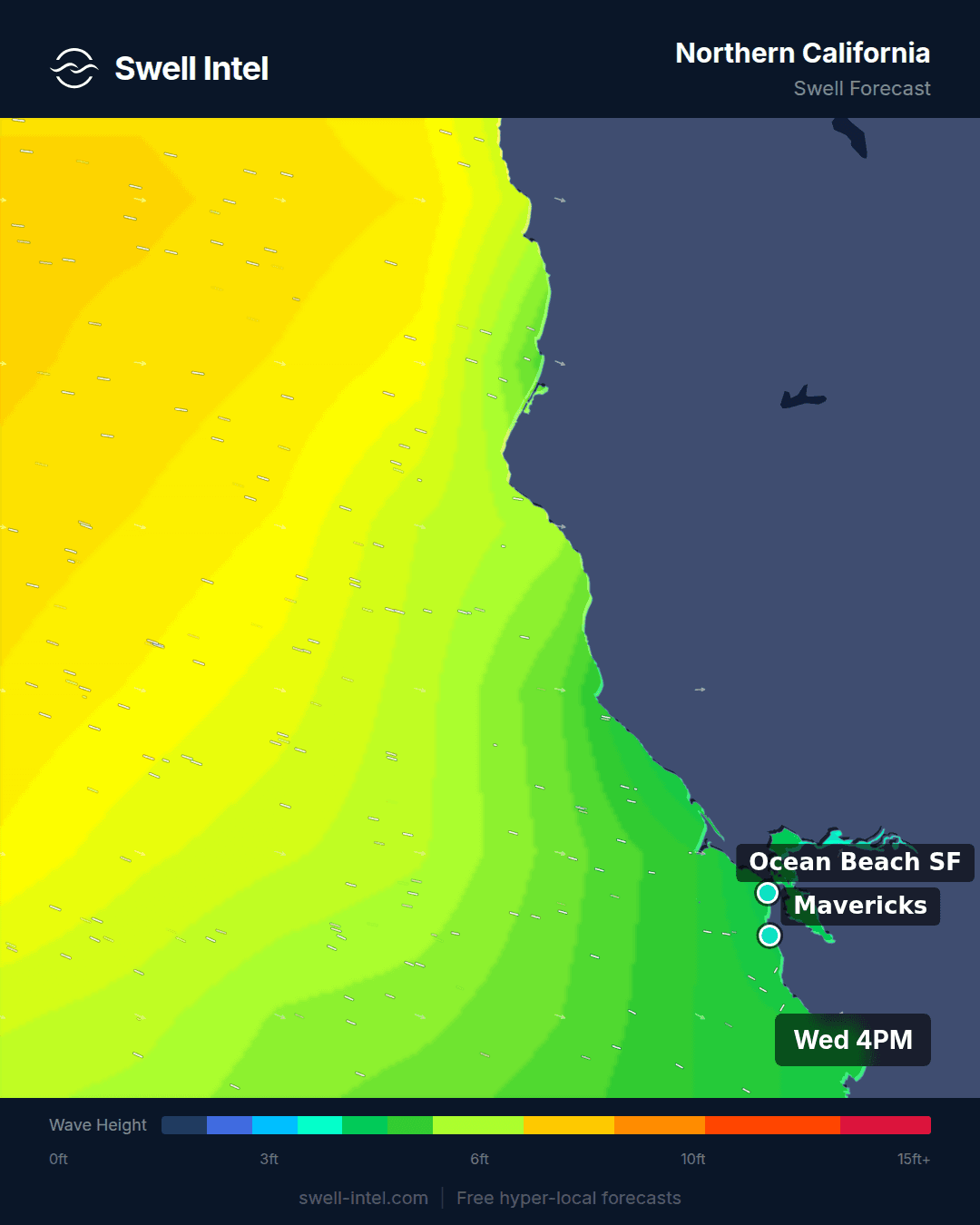
A northwest swell arriving at 290° has to bend more than 90 degrees to reach a south-facing reef. That bending is refraction: as a swell moves into shallower water it slows, and the part of the wave in shallower water slows first, pivoting the crest toward the coastline. Santa Cruz is, functionally, a giant refraction machine. Waves get there, but only after paying a large tax in height. The practical consequence is that Ocean Beach can be well overhead and closing out while Steamer Lane is a clean, workable chest-high on the exact same swell.
Refraction is also strongly period-dependent, and this is the detail that separates people who score Santa Cruz from people who guess at it. Longer waves feel the seafloor in deeper water, so they start bending sooner and bend further. A 17-second northwest groundswell wraps deep into the bay and lights up the points well past the Lane. An 11-second northwest windswell of the same offshore height barely turns the corner and mostly dies before it gets there. In Santa Cruz, period is not a quality modifier — it is an access requirement. We wrote the long version of this in swell period explained.
The south-facing geometry pays a second dividend. That same northwesterly wind that turns the exposed coast to mush blows side-offshore across the Santa Cruz west side. It is why the town holds shape on days when everything north of the county line is unrideable — and why, in summer, the south-facing window takes Southern Hemisphere swell cleanly while the rest of the coast sits flat. The Monterey Peninsula and Point Lobos trim the southeastern end of that window, so due-south and SSE directions arrive shadowed; the meat of the summer window is roughly S through SW.
What the Monterey Canyon does to a forecast
Monterey Bay is incised by one of the largest submarine canyons in North America. The Monterey Canyon runs from near Moss Landing out into deep water, and it is a violent discontinuity in the seafloor: swell crossing it goes from feeling bottom to not feeling bottom and back again over a short distance, which refracts and diffracts energy into focused beams and shadowed gaps.
The measured effect is dramatic. Field studies over submarine canyons of this class have recorded nearshore wave heights varying by as much as a factor of four across roughly a kilometer of shoreline, with wave direction shifting by around ten degrees over the same span. That is not noise. That is two spots within sight of each other having completely different days.
This is exactly the gap between a buoy and a forecast. A buoy is a single point in deep water reporting what the open ocean is doing. It cannot tell you what the last three miles do to that energy — and on this coast, the last three miles do almost everything. Our nearshore SWAN grids run at tens of meters through the surf zone specifically to resolve it, and we rebuilt the Santa Cruz transforms on a much larger physical domain so the Monterey Peninsula and Point Lobos block and bend each direction the way the real coastline does. Every swell train is transformed separately, with its own period, direction and shadow geometry, before they are recombined at the beach — which matters enormously somewhere a 17-second NW and an 11-second NW arrive at completely different sizes. The engineering write-up is in our forecast engine upgrade.
Month by month
September — the season opens
A transition month, and an underrated one. The first organized long-period NW groundswells of the year show up, often still with leftover Southern Hemisphere south swell in the water. Winds are light, mornings are frequently glassy, and the water is the warmest it will be all year. Size is moderate rather than large — think waist- to head-high on the better NW pulses at the Lane. The ratio of clean days to blown-out days is the best it gets.
October — the peak quality month
If you get one week on this coast, take it now. The North Pacific is fully active but the storm track is still far enough north and west that energy arrives as long-period groundswell rather than close-range storm surf. Local wind stays weak, offshore mornings are common, and water temperature is at its annual maximum. Sizes step up — head-high to a couple of feet overhead is a normal good day at the Lane, considerably more on the exposed coast.
November — size arrives, consistency wobbles
The Aleutian Low deepens and the first genuinely large swells of the winter land. Quality is still often excellent, but the first frontal systems start bringing local wind and rain, so the calendar begins splitting into good days and write-offs rather than a steady run. Mavericks typically comes into play from about this point.
December to February — maximum size, narrower windows
Peak swell frequency and peak size. Also peak storminess: fronts bring south and southwest winds that flatten the surface, and rain runoff degrades water quality for a day or two afterward. The winter play is timing rather than hoping. The best sessions consistently land in the 24 to 48 hours after a front clears, when the swell is still standing up and the wind has swung offshore behind the system. Learning to read those gaps is worth more here than anywhere else on the coast — our piece on how far out you can trust a surf forecast is directly relevant to how early you can commit to one.
March and April — the honest low point
There is still swell in the water. There is often not much you can do with it. The North Pacific High rebuilds, the upwelling-favorable northwesterlies return at full strength, and most days go onshore early. Water temperature falls to its annual minimum. This is the hardest stretch of the year to score, and pretending otherwise does nobody any favors — plan for dawn sessions and short windows, or plan a trip somewhere else.
May to August — south swell and morning-only
NW swell supply drops off and the Southern Hemisphere takes over. Santa Cruz's south-facing setup makes it one of the better places in the state to use those swells, though at this latitude they arrive smaller than they do further south. Wind rules the day: mornings can be lovely, afternoons are usually finished by noon. The southern counterpart to this article, SoCal south swell season, covers where that same energy lands with more punch.
The spots, and what each one wants
- Steamer Lane — the reef at Lighthouse Point, right at the tip of the headland, so it sees NW energy before the rest of the bay shadows it. Works across a wide size range and handles northwest wind. The benchmark for whether Santa Cruz is on.
- Pleasure Point — further east and more shadowed, so it needs either more size or, better, more period. On a long-period NW it is a long, mellow point wave; on a short-period one it will be noticeably smaller than the Lane.
- Cowell's — the most sheltered corner in town and a genuine beginner and longboard wave. It is small by design, which is the point; when the coast is oversized this is where it is still surfable.
- Ocean Beach — the opposite philosophy. Straight into the swell window, no shelter, no wrap tax. It gets everything, which is a blessing about two days a month and a problem the rest of the time. Needs light or east wind and a manageable period to have paddle-out lanes at all.
- Pacifica — the accessible exposed-coast option, a step down in consequence from Ocean Beach on most swells.
- Bolinas — sheltered behind the headland to the north, so it works on the same principle as Santa Cruz: small, protected, and useful when the open coast is out of hand.
- Mavericks — a deep-water reef that needs a large, long-period WNW–NW swell and light wind, roughly November through March. Genuinely expert-only; it is on this list because it defines the season, not because it is an option for most people.
Cold water, rocks, and the honest hazard list
Northern California asks more of you than most coastlines. A 4/3 wetsuit with hood and booties is standard from November through April; a 3/2 covers the fall window. Entries and exits at the Santa Cruz reefs are over rock and require timing rather than enthusiasm. Water quality drops for a day or two after heavy winter rain. And this stretch of coast has a genuine seasonal peak in white shark activity in the autumn months — worth knowing, worth not being dramatic about, and not on its own a reason to stay out of the water.
One last piece of honesty about everything above: these are climatological tendencies, not guarantees. A given October can go quiet and a given March can deliver a run of offshore mornings. Climatology buys you odds, not certainty — which is exactly why you still check the forecast.
Track it live in Swell Intel
Seasonal patterns tell you when to pay attention. They cannot tell you whether Thursday morning is worth the drive over the hill. Swell Intel runs buoy-anchored nearshore SWAN forecasts for Steamer Lane, Pleasure Point, Cowell's, Ocean Beach, Pacifica, Bolinas and Mavericks — breaking wave height rather than open-ocean height, with swell direction, period, wind and tide updated hourly. Set an alert for the period and direction your break actually needs, and let the wrap do the rest.
Track Northern California live on Swell Intel →
📱 Get spot-by-spot forecasts, dawn patrol alerts, and buoy-trained ratings in the SwellIntel app.