
Tropical Storm Elida Delivers for SoCal — Weekend Surf Forecast: July 18-19, 2026
The East Pacific tropics delivered. The system we were watching midweek has organized into Tropical Storm Elida, and its long-period swell is now in range of our nearshore SWAN model — a 50-meter-resolution model that resolves how that energy refracts, shoals, and breaks at each specific spot, not just what a buoy reads offshore. For July 18–19, Elida is the headline: a solid south/southwest swell lighting up Southern California's south-facing points and reefs, with real spot numbers now that it's inside our grid.
Honest read for the rest of the country: it's a quiet weekend. Outside of SoCal, most of the coast — the East Coast, Puerto Rico, and the bulk of the West Coast beachbreaks — is small, soft, and one for the longboard or a rest day. Below is Elida's SoCal payoff first, then a spot-by-spot read of where else it's worth paddling out.
Southern California
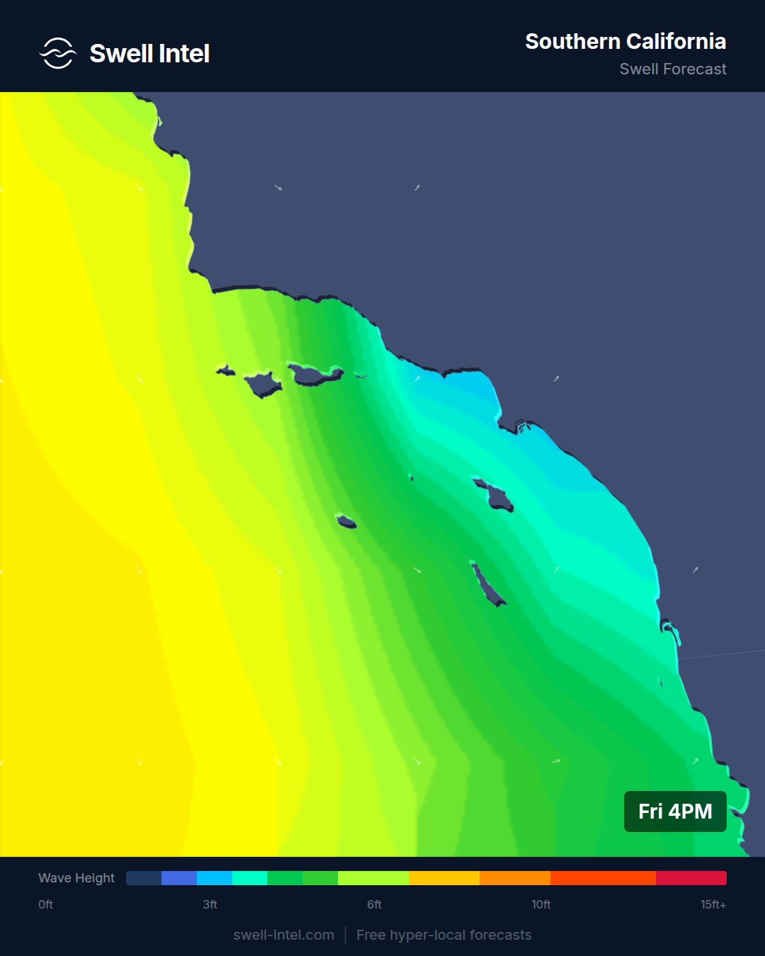
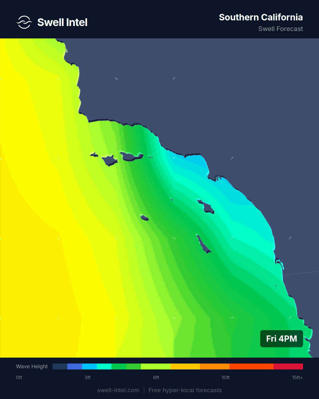
Surf: up to ~6ft (head-high) at the standout south-facing spots • Best day: Sunday AM • Conditions: Good
This is the payoff of the Hurricane Swell Watch we ran midweek. Tropical Storm Elida organized in the eastern Pacific a few hundred miles south-southwest of Mexico and tracked west-northwest, and its long-period energy has now moved into range of our 50-meter nearshore grid — so instead of the out-of-range global-model guess we could only make on Wednesday, we've got real spot numbers. Our model reads the swell at roughly 13 seconds from about 225°, a south/southwest line that's reinforcing the season's ongoing south swell and wrapping cleanly into the south-facing points and reefs. That long period is the tell: tropical energy at 13-plus seconds carries efficiently and stands up with power on the right-facing setups.
On size, this is a genuinely good weekend at the standout spots. Our model has Trestles head-high — around 6ft with some sets going a up to 2 feet over head — with Malibu's First Point and Huntington Pier chest-to-head-high at roughly 5-6ft, all graded Good. Cardiff Reef steps down to waist- to chest-high, and the straight west-facing beach breaks like El Porto stay waist-high because they don't sit open to the south. At 225° this is a south/southwest swell, so the south- and southwest-facing points and reefs — Trestles, Malibu, Huntington — are exactly where it focuses. Confidence is high on size and direction now that the swell is inside our nearshore run: a real step up from the low-confidence, out-of-range call we could only make midweek.
Timing: go early. Our ratings peak at dawn and ease off through the day as the afternoon sea breeze turns onshore, and Sunday morning grades out best of the two days. One honest caveat on tropical swell — systems like Elida track west-northwest and can nudge their fetch on or off our swell window quickly, so treat these numbers as our best nearshore read for the weekend rather than a lock, and check back as she moves. But the energy is real and in range now, and the south-facing points are the call.
Northern California
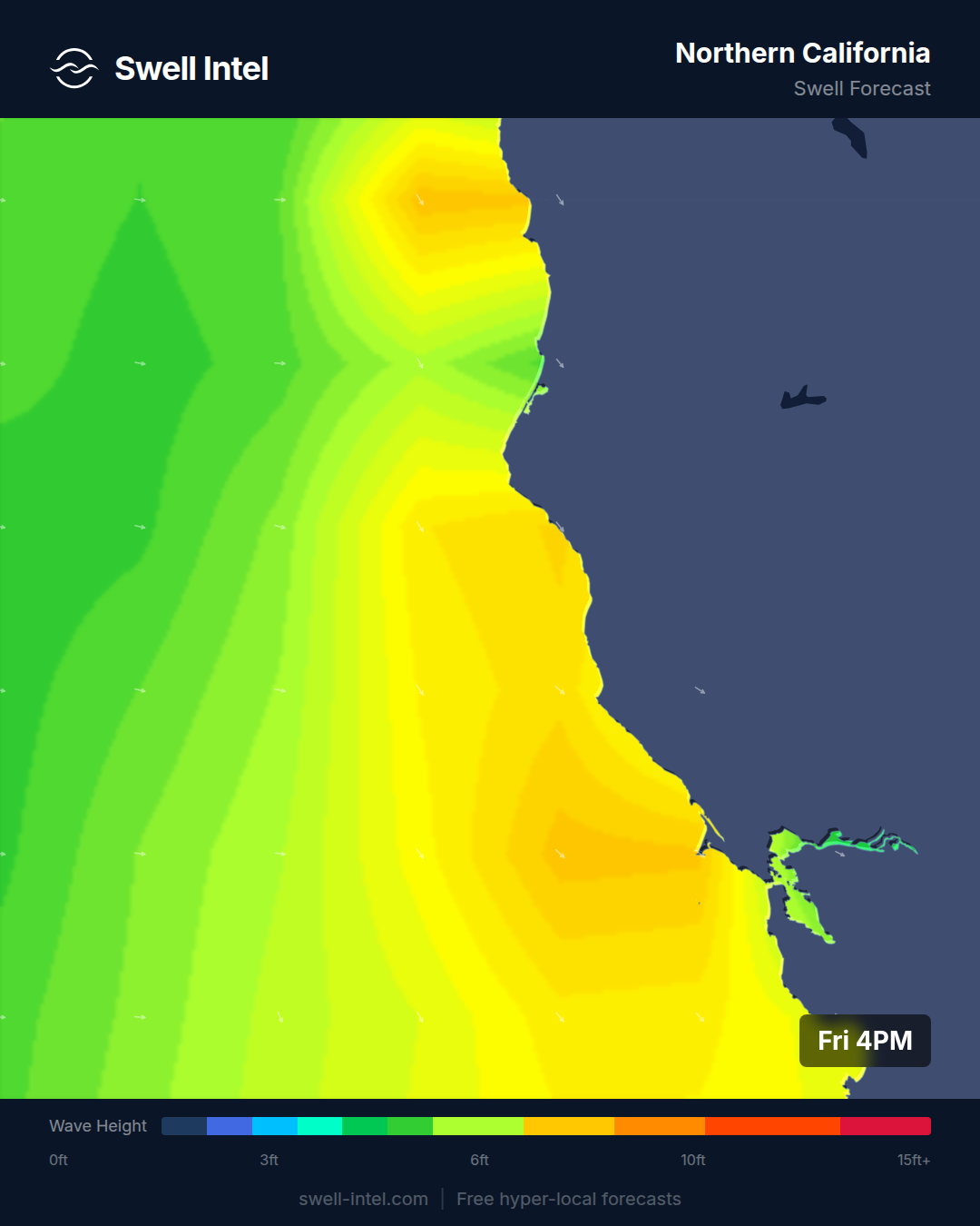
Surf: 2-3ft • Best day: Sunday AM • Conditions: Poor-Fair
There's not a lot to work with up here. Our model has Ocean Beach in San Francisco picking up a long-period south swell — around 15 seconds from ~204° — reaching up the coast, and that's why OB is the one spot showing real size (up to about 4ft) while Linda Mar in Pacifica stays waist-high. But the grades are Poor-Fair across the board: the south angle is a glancing one for these west/northwest-facing beaches, and without a clean NW groundswell there's little organization to it.
If you're going, Ocean Beach on the long-period south in the Sunday morning window — before the wind — is the play, with the caveat that OB is heavy and shifty and worth a spot-check rather than a blind drive. NorCal's real season is fall and winter NW groundswell; this weekend is off-season filler, and the model isn't dressing it up as anything more.
Pacific Northwest
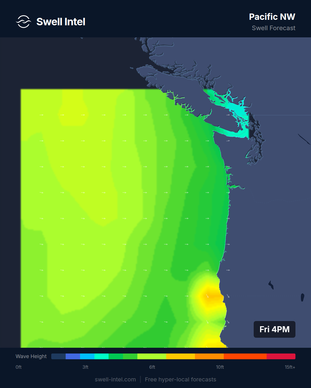
Surf: 2-3ft • Best day: Saturday AM • Conditions: Fair-Good
The bright spot of the northern coast. A short-period west-northwest windswell — roughly 7 seconds from ~295–305° — is feeding the Oregon and Washington beaches, and Indian Beach is the standout at up to ~4ft with Fair-Good conditions. Seaside Cove, Cape Kiwanda, and La Push are all in the 3ft range but a notch lower at Poor-Fair — the difference is exposure and how each one handles the wind.
Up here wind is always the deciding variable, and our model likes Saturday morning best — get it early before the afternoon breeze fills in. Indian Beach's tucked-in aspect is exactly why it grades ahead of the more exposed beachbreaks. Honest confidence: medium. Short-period windswell is fickle and wind-dependent, so treat the Fair-Good at Indian Beach as the ceiling for the weekend, not a promise.
New York / New Jersey
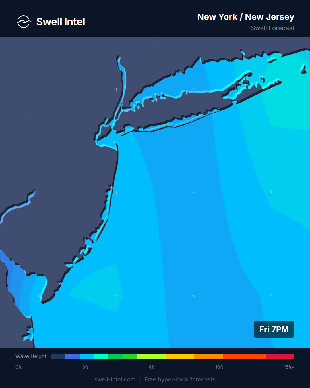
Surf: 1-2ft • Best day: Sunday PM • Conditions: Poor-Fair
Small and soft. Our model has Rockaway, Manasquan, and the NJ beaches all around knee- to waist-high on a weak, short-period south/southeast windswell — under 5 seconds from ~170°. That's local wind-driven slop, not organized groundswell, and our internal cross-check backs it up in the shin- to knee-high range. This is a longboard-or-skip weekend.
If you want to get wet, the ratings actually tick up a touch into Sunday afternoon, so the back half of the weekend is marginally cleaner than the mornings — the opposite of most of the coast right now. But be honest with yourself about expectations: the mid-Atlantic wakes up in the fall on hurricane groundswell and nor'easters, and mid-July is the off-season here.
New England
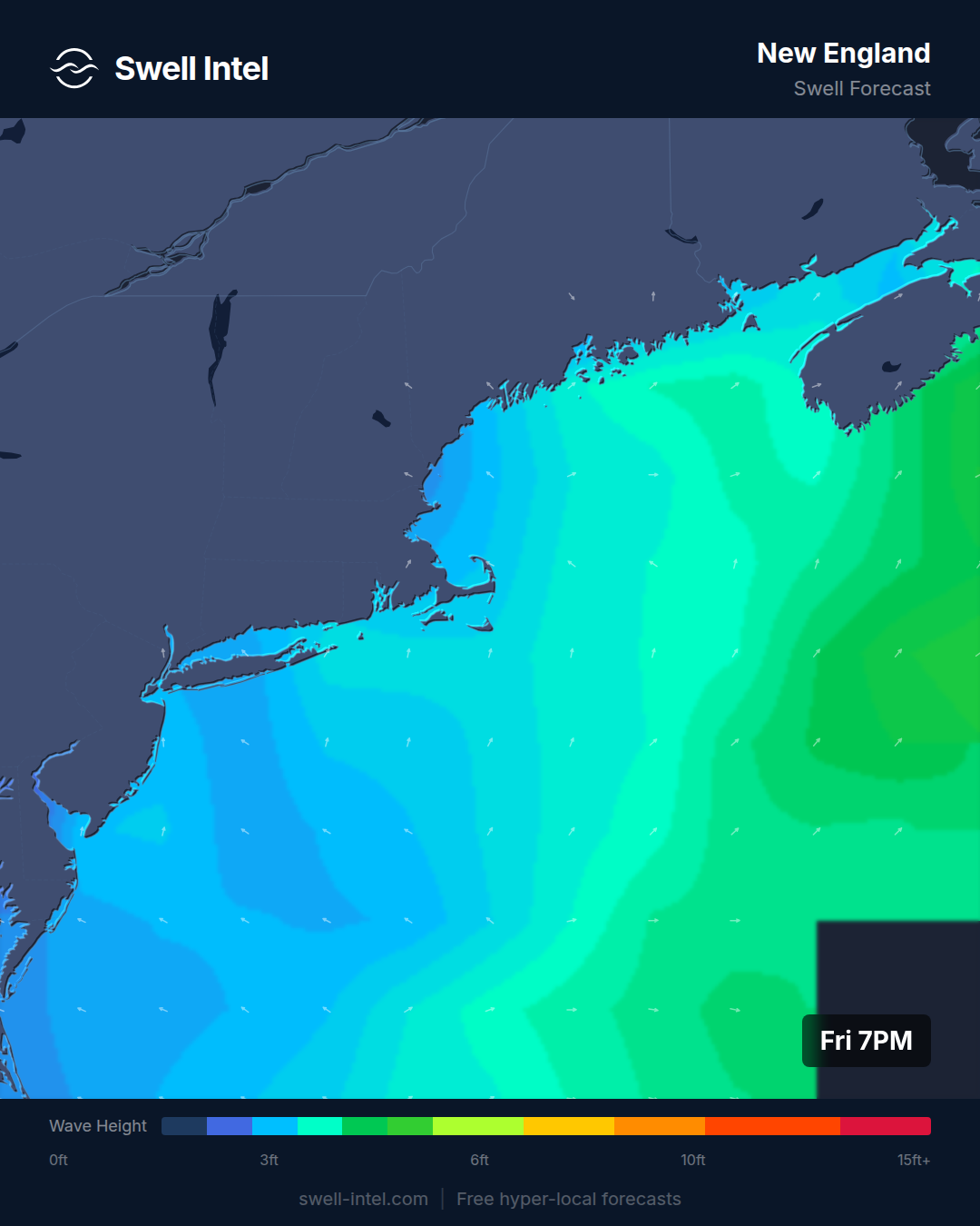
Surf: 1-2ft • Best day: Saturday AM • Conditions: Poor-Fair
Also small. The Rhode Island spots — Narragansett Beach and Misquamicut — face south/southeast and are catching a weak short-period south windswell (around 4.7–4.8s from ~185°), good for up to about 3ft but rated Poor-Fair. Up in New Hampshire and Massachusetts, Hampton Beach and Nantasket are essentially flat, sitting on 2–3 second wind chop rather than any real swell.
Best of a modest bunch is Saturday morning at the RI beaches, before conditions slide through the rest of the day. This is a wait-for-fall region: hurricane groundswell and winter nor'easters are what light New England up, and neither is anywhere on the board this weekend.
Outer Banks
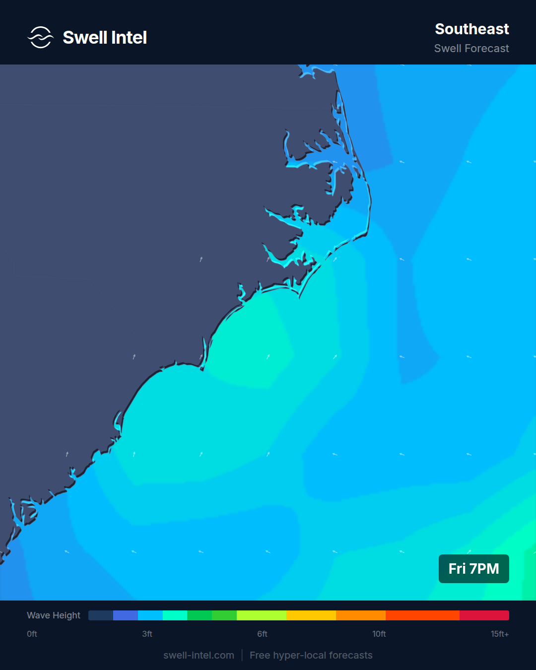
Surf: 1-2ft • Best day: Sunday AM • Conditions: Fair
The best of a quiet East Coast — which isn't saying a ton, but Cape Hatteras is the one spot on the entire seaboard our model grades as Fair rather than Poor. Hatteras juts farther out into the Atlantic than anywhere else on the coast, so it squeezes rideable waves out of even marginal swell: here it's about 3ft on a short-period south/southwest windswell (~4s), best in the Sunday morning window before it fades through midday and drops off in the afternoon.
Folly Beach down in South Carolina is smaller and rated Poor. Nothing groundswell-driven is in play, but if you're on the Carolina coast, Hatteras at dawn Sunday is the call. Real size here waits on NE groundswell and the heart of hurricane season — still a few weeks out.
Florida East Coast
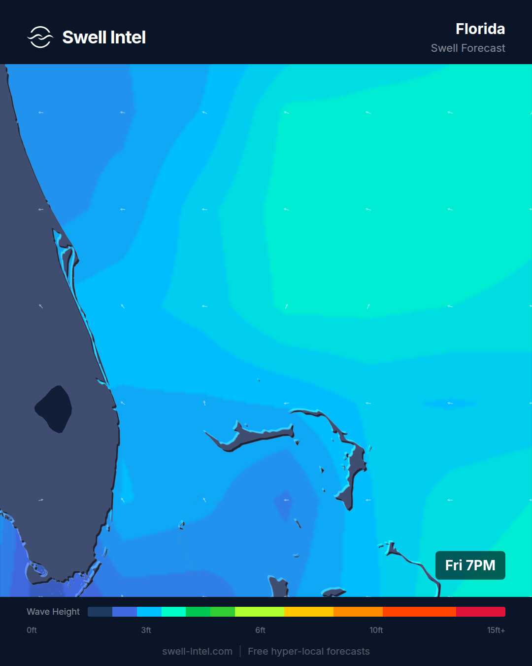
Surf: 0-1ft • Best day: Sunday AM • Conditions: Poor-Fair
Close to flat. Cocoa Beach, Sebastian Inlet, and Jacksonville Beach are all sitting at ankle- to knee-high on weak 6–7 second east/northeast windswell, and our model rates the whole stretch Poor to Poor-Fair. Sebastian Inlet — normally the quality spot on the Space Coast — is the smallest of the three this weekend at barely a foot.
Mornings are marginally cleaner than afternoons, so Sunday at dawn is your least-bad option, but honestly this is a longboard, foamie, or rest-day weekend for Florida. The East Florida coast comes alive on wrapping tropical/hurricane swell and winter cold-front windswell — we're sitting between those sources right now.
Puerto Rico
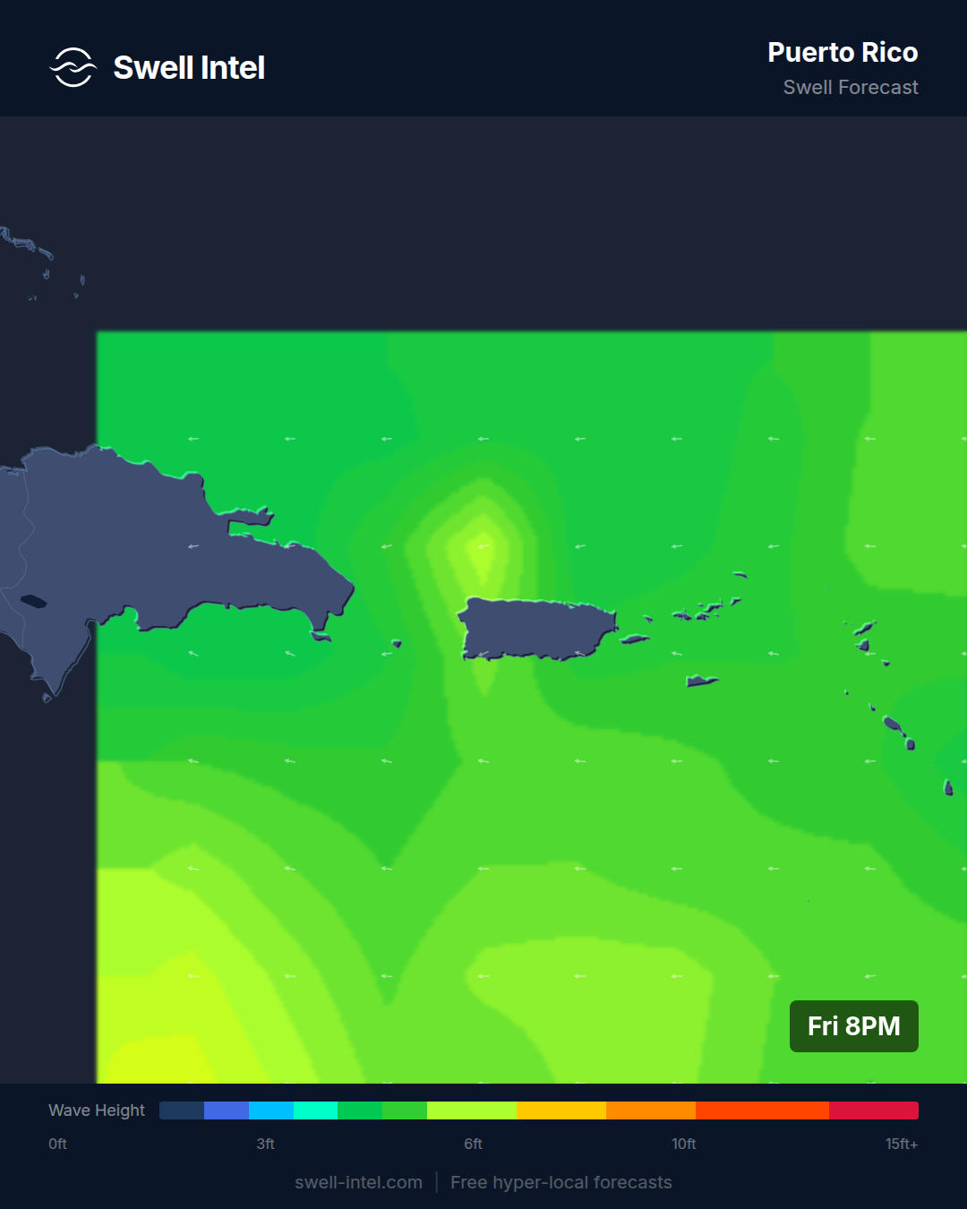
Surf: 0-1ft • Best day: Sunday PM • Conditions: Poor
Flat — and that's exactly what you'd expect. This is the off-season for Puerto Rico: the island's engine is North Atlantic north/northwest groundswell that runs from roughly October through April, and in mid-July that source is dormant. Our model has Rincon's Maria's at barely a foot and Very Poor, with Wilderness up near Aguadilla only marginally better at ~2ft and Poor.
There's no swell window worth chasing this weekend; the slightly better Sunday-afternoon rating is only 'least-bad' in a relative sense. Save it. When winter returns, this coast is one of the best warm-water setups anywhere — Wilderness runs bigger than Rincon (often 6–8ft to Rincon's 4–6ft), while Maria's is the cleaner, high-performance play a couple feet smaller. Just not now.
Track it live in Swell Intel
Conditions shift as each model run refreshes. Get the live, spot-by-spot nearshore forecast — size, period, direction, and wind for your break — at swell-intel.com. See what our 50 m model sees that a buoy can't.